Posted tagged ‘Desert’

Monday

July 30, 2013

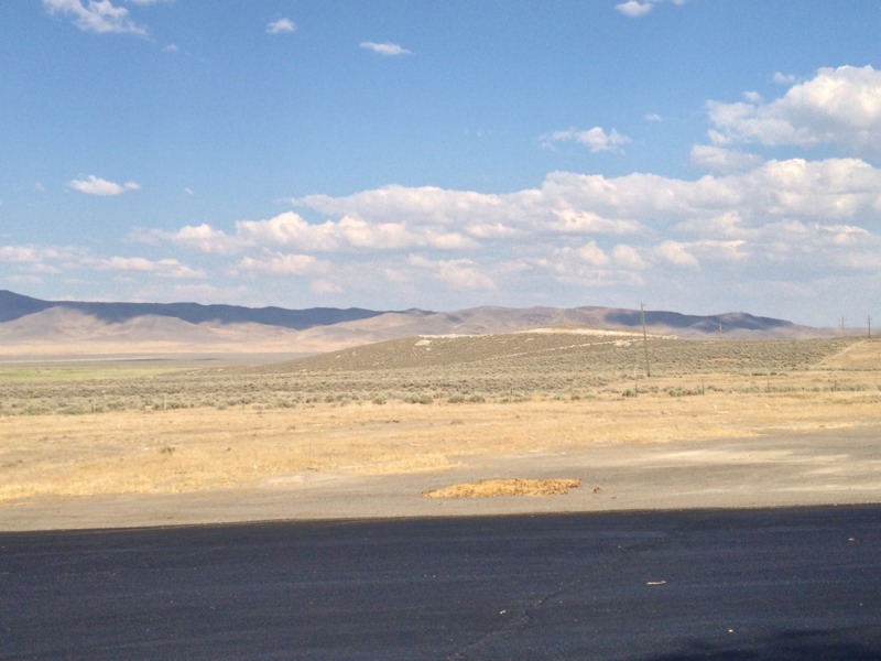
Posting a little late today. iPad battery dead last night. Had to wait to get it charged. Yesterday we traveled from Elko, NV across the Nevada high dessert to Salt Lake City, UT. Long, straight road with desert as far as the eyes can see.

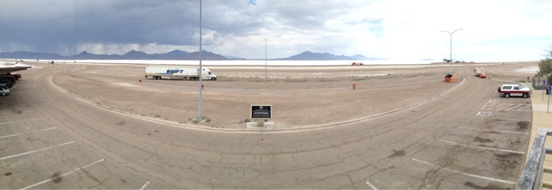
At the NV-UT state line we start seeing salt flats. It looks somewhat like snow, but you know that it’s not.

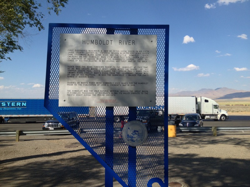
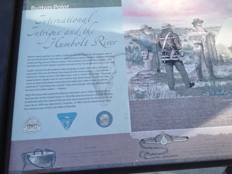
Here are a few pictures that I took at the rest area at Wendover, UT. This is where the famous Bonneville Salt flats are located.


We checked into our hotel and then did some grocery shopping for dinner. Then we met up with Mary K. and then left for Neil and Dawn’s house. We had a loverly steak dinner with Neil and his family.

Drive on Monday was relatively short. We only did about 250 miles. So we arrived at 4pm which included change in time zone to MDT.

Today we are off to visit Park City.

– Posted using BlogPress from my iPad

And the Adventure Continues…

July 29, 2013

Much to tell. Yesterday started with OES Reception for the Grand Organist. That was in Rancho Cordova (East of Sacramento), That lasted until 4pm. Then off to Chico for reception for Grand Ruth. Ninety miles up and ninety miles back, We got back to our hotel at 12:30am.

So up today at 7:00 am and off at 10am. Heading east on I80 towards NV. First stop was at Donner Pass. Elev 7056′

The Donner pass is named for the Donner Party who perished in November 1846 after getting snow bound by early winter storm. Read the Wiki entry for more detail than you ever needed. See link above.


West side of the Sierras are verdant and the east side is arid. All of the moisture from the Pacific stays to the west of the Sierras. We stopped for lunch and then stopped at a rest area at Button Point in NV.

Bathrooms were the worst we’ve seen in all of our travels. Took a a few pictures. Notice all of the green is gone. All you see is sand, salt flats, and sage brush.


Button Point is part of the Humboldt River basin. Here’s the Wikipedia entry.

Finally after driving 435 miles today we arrived at our hotel in Elko, NV.

By the way, Mary safely made it to LAX to fly to SLC. Mike took her to LAX and Neil picked her up. We will be in SLC tomorrow to visit with Neil and his family.

– Posted using BlogPress from my iPad

Location:Elko, NV

Joshua Tree National Park

April 19, 2013

On Friday, Paula and I decided that we needed a day off of the grid. So we decided to take a day trip out to Joshua Tree, CA. Joshua Tree is about 150 miles east of Los Angeles in the middle of the Mojave desert. We left San Pedro around 0930. Light to medium traffic out the 91 freeway. Most people were heading in the other direction. We stopped for lunch at a Carrow’s in Yucca. I checked my iPhone for any updates on the Boston Marathon bombers. Not much new news. It was a beautiful day. Clear skies and about 75 degrees.

Twenty minutes later we arrived at the Joshua Tree information center. We talked to a very nice park ranger who gave us a map. We paid $10 for a lifetime National Park service pass. This was the first time that I have ever been carded for my status of being over 65. Then off we went to the park. So here are the pictures taken by my trusty iPhone 4S.


This my friends is a Joshua tree. We had hoped that the trees would be in bloom, but we think that we were a little bit early or perhaps not enough rain over the winter.


Lots of boulders.


This is a Yucca plant. Much of the flora in the desert has evolved to that it can survive in the desert with little or no water.


Some of the plants were blooming.


Cactus flowers.


It is amazing how a plant can survive in the cracks between the boulders.


Big boulders.


Yucca with a bloom.


This is view from Keyes View. The view is towards the San Rosa mountains and the San Andreas fault.


This picture was taken using the iPhone’s panorama mode.

So it was getting on to be 4:30pm and we wanted to be back to San Pedro by 7:30pm. So we hit the road back west towards LA. Next time we might try to stay a little longer.

– Posted using BlogPress from my iPad

Location:Joshua Tree, CA

Day 20 Journey’s End

August 22, 2012

After 4958 miles, we pulled into San Pedro, CA. We left Jean NV about 9AM, stopped at rest area just across the CA-NV border. Took a few pictures of the desert and the joshua trees. Weather starts out hot in the morning and gets hotter.

We talked with an older woman who worked in the dining room of the hotel. She had noticed my iPad. She said that she had a Kindle-Fire. She told us that when she was done with her shift she would go out in the desert and search for a geo-cache, but only if it didn’t get too hot. Too hot would be if it got over 105.

Here are a pictures from the rest area at Valley Wells, CA (aka. the middle of nowhere).


We stopped in Victorville for lunch at a Coco’s. For you easterners, Coco’s a restaurant franchise mostly in CA. Much like IHOP or Denny’s.

We finally hit the rush hour traffic of the I10 and I110. Nothing like the adrenaline rush of driving in LA traffic on freeways with 5 or 6 lanes across at 65 mph. One must keep your eyes on all three mirrors, GPS, and road ahead.

We spent the next couple of hours partially unloading the Jeep. Then finally dinner at Nico’s Pizzeria in San Pedro with Mike, Theresa and Jonathan.

Wednesday more unloading and dealing with keys and garage door openers. I’ll write another whole post on hotels.

– Posted using BlogPress from my iPad

Location:San Pedro, CA